2007
SP7227 : Farm road, Windmill Hill Farm near Sandhill
taken 17 years ago, near to Middle Claydon, Buckinghamshire, England
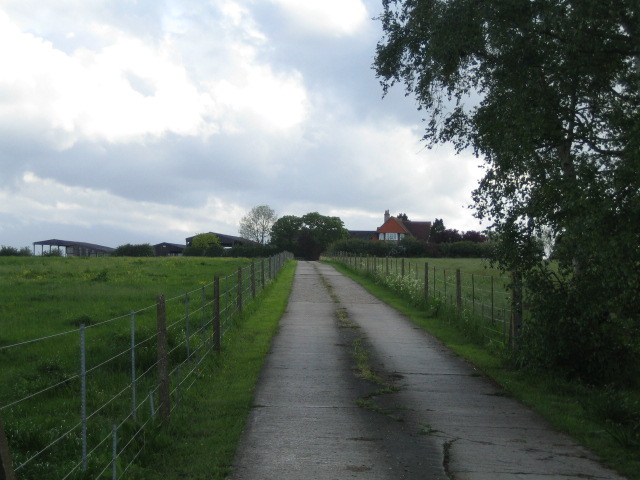
Farm road, Windmill Hill Farm near Sandhill
This farm road heading south-east, which is off the C road between East Claydon and Padbury, leads to Windmill Hill Farm. There is no evidence of a windmill nearby on the modern or 1940s OS map, though the farm is close to the top of a hill of over 100m
 Map © Crown Copyright")
TIP: Click the map for more Large scale mapping
- Grid Square
- SP7227, 22 images (more nearby 🔍)
- Photographer
- Andy Gryce (more nearby)
- Date Taken
- Saturday, 12 May, 2007 (more nearby)
- Submitted
- Tuesday, 10 July, 2007
- Subject Location
-
OSGB36:
 SP 721 277 [100m precision]
WGS84: 51:56.6092N 0:57.0714W - Camera Location
-
OSGB36: SP 723 278
- View Direction
- Southwest (about 225 degrees)