2013
SN3760 : The Wales Coast Path
taken 11 years ago, near to New Quay, Ceredigion/Sir Ceredigion, Wales
This is 1 of 2 images, with title The Wales Coast Path in this square
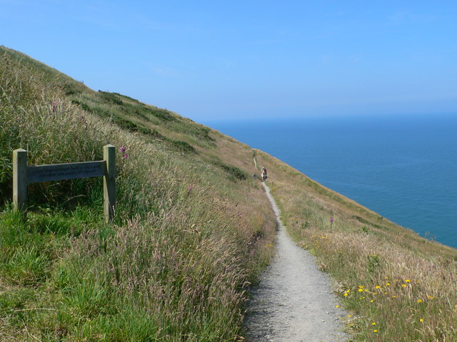
The Wales Coast Path
The path is some 70m above sea level. The sign indicates that there is an alternative path which is not as close to the edge.
 Map © Crown Copyright")
TIP: Click the map for more Large scale mapping
- Grid Square
- SN3760, 19 images (more nearby 🔍)
- Photographer
- Eirian Evans (more nearby)
- Date Taken
- Thursday, 11 July, 2013 (more nearby)
- Submitted
- Wednesday, 13 April, 2016
- Subject Location
-
OSGB36:
 SN 378 601 [100m precision]
WGS84: 52:12.9112N 4:22.4926W - Camera Location
-
OSGB36: SN 378 601
- View Direction
- WEST (about 270 degrees)