2007
SO8351 : Skips in Powick
taken 17 years ago, near to Powick, Worcestershire, England
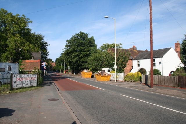
Skips in Powick
After the deluge the River Teme burst its banks and the A449 Malvern to Worcester road was flooded and so were the houses in Powick. The skips are full of flood damaged material from the homes of villagers who spent the night at the Red Lion.
 Map © Crown Copyright")
TIP: Click the map for more Large scale mapping
- Grid Square
- SO8351, 93 images (more nearby 🔍)
- Photographer
- Bob Embleton (more nearby)
- Date Taken
- Sunday, 8 July, 2007 (more nearby)
- Submitted
- Wednesday, 11 July, 2007
- Subject Location
-
OSGB36:
 SO 832 516 [100m precision]
WGS84: 52:9.7880N 2:14.7511W - Camera Location
-
OSGB36: SO 833 517
- View Direction
- Southwest (about 225 degrees)