2016
SY6380 : #1 Butter Street, East Fleet
taken 8 years ago, near to Fleet, Dorset, England
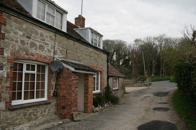
#1 Butter Street, East Fleet
There is an Ordnance Survey benchmark on this property. See SY6380 : Benchmark, #1 Butter Street, East Fleet. Most of the village of Fleet and its old church was washed away during the great gale of November 1824.
 Map © Crown Copyright")
TIP: Click the map for more Large scale mapping
- Grid Square
- SY6380, 71 images (more nearby 🔍)
- Photographer
- Becky Williamson (more nearby)
- Date Taken
- Thursday, 21 April, 2016 (more nearby)
- Submitted
- Saturday, 23 April, 2016
- Subject Location
-
OSGB36:
 SY 6357 8007 [10m precision]
WGS84: 50:37.1515N 2:30.9788W - Camera Location
-
OSGB36: SY 63572 80067
- View Direction
- North-northeast (about 22 degrees)