2016
SJ9592 : If the Queen could see it now
taken 8 years ago, near to Gee Cross, Tameside, England
If the Queen could see it now
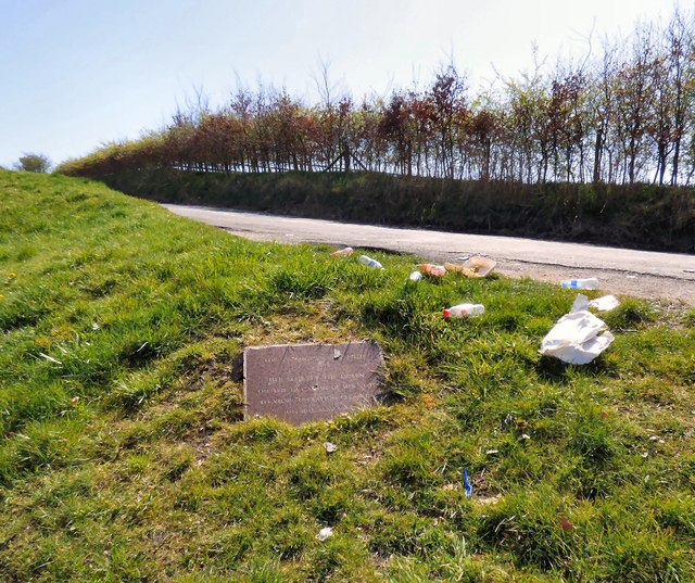
The plaque records the planting of a sycamore by Her Majesty The Queen on the occasion of her visit to view Operation Clean Up on 16th May 1968.
The triangle of land at the junction of Werneth Low Road and Cowlishaw Road was given to Bredbury & Romily UDC by Walter Mansfield.
The site affords wide views across the north and east of Greater Manchester.
Alas many of the people who gather here dump their rubbish rather than taking it home for disposal.
 Map © Crown Copyright")
TIP: Click the map for more Large scale mapping
- Grid Square
- SJ9592, 92 images (more nearby 🔍)
- Photographer
- Gerald England (more nearby)
- Date Taken
- Wednesday, 20 April, 2016 (more nearby)
- Submitted
- Sunday, 24 April, 2016
- Subject Location
-
OSGB36:
 SJ 9547 9236 [10m precision]
WGS84: 53:25.6806N 2:4.1785W - Camera Location
-
OSGB36: SJ 9547 9236
- View Direction
- SOUTH (about 180 degrees)