2007
NG2196 : Harbour, Scalpay
taken 17 years ago, near to Ceann a Bhàigh, Scalpay, Na h-Eileanan an Iar, Scotland
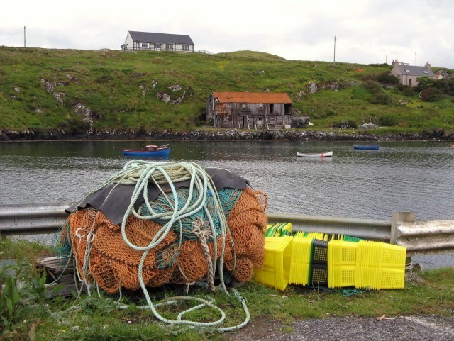
Harbour, Scalpay
A natural anchorage still used by fishing boats. The ruined building on the opposite shore was a fish curing station.
 Map © Crown Copyright")
TIP: Click the map for more Large scale mapping
- Grid Square
- NG2196, 58 images (more nearby 🔍)
- Photographer
- Eileen Henderson (more nearby)
- Date Taken
- Friday, 6 July, 2007 (more nearby)
- Submitted
- Wednesday, 11 July, 2007
- Subject Location
-
OSGB36:
 NG 213 968 [100m precision]
WGS84: 57:52.4201N 6:42.1174W - Camera Location
-
OSGB36: NG 213 968
- View Direction
- West-southwest (about 247 degrees)