2016
NH5328 : Urquhart Castle
taken 8 years ago, near to Strone, Highland, Scotland
This is 1 of 36 images, with title Urquhart Castle in this square
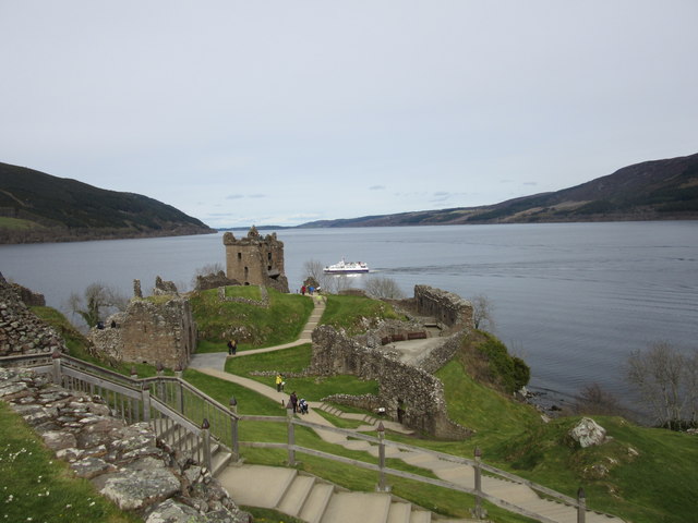
Urquhart Castle
Urquhart Castle dates from the medieval period and despite the fighting it witnessed over the years, survived until 1692 when the Clan Grant, who were garrisoning the castle on behalf of the Hanoverians, blew it up to prevent it falling into the hands of the Jacobites.
 Map © Crown Copyright")
TIP: Click the map for more Large scale mapping
- Grid Square
- NH5328, 205 images (more nearby 🔍)
- Photographer
- Euan Nelson (more nearby)
- Date Taken
- Sunday, 24 April, 2016 (more nearby)
- Submitted
- Wednesday, 27 April, 2016
- Subject Location
-
OSGB36:
 NH 5307 2859 [10m precision]
WGS84: 57:19.4469N 4:26.5090W - Camera Location
-
OSGB36: NH 5303 2855
- View Direction
- Northeast (about 45 degrees)