2011
SX8750 : Arch in Bayards Cove Fort
taken 13 years ago, near to Dartmouth, Devon, England
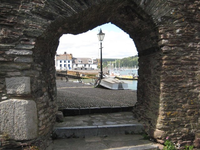
Arch in Bayards Cove Fort
An unusually shaped arch in Bayards Cove Fort in Dartmouth. This is a Grade I listed building which on the Historic England website is named as Bearscove Castle.
Historic England description
Small artillery castle, built to protect the town quay. Possibly 1509-10 on documentary evidence, it was certainly in existence by 1537. Local limestone rubble. PLAN: A platform cut into the rock enclosed by a thick curving wall projecting into the estuary. EXTERIOR: Thick rubble wall with a regular series of putlog holes. Doorway on northern side onto the quay (although, according to Freeman, the quay did not extend this far until 1839). It is a plain doorway with an irregular 2-centred arch head under a hoodmould. 11 splayed gunports externally rebated for shutters; they are designed for guns mounted on flat beds. Parapet mostly collapsed but the bottom courses remain, projecting slightly on a row of small corbels. INTERIOR: Unroofed. Remains of stone steps to wallwalk. Sockets for timbers in cliff to rear from old lean-to structures - the place was apparantly (sic) used for storage in times of peace. Bearscove Castle is sited at the end of a fine and picturesque row of listed buildings on the old town quay. (Archaeologia: O'Neil BH St J: Dartmouth Castle and other defences of Dartmouth Haven: 1935-: P.129-157; Saunders AD: Dartmouth Castle, Devon: HMSO: 1986-; Freeman, Ray: Dartmouth and its Neighbours: Phillimore: 1990-: P.54).
Source:Link
 Map © Crown Copyright")
TIP: Click the map for more Large scale mapping
- Grid Square
- SX8750, 184 images (more nearby 🔍)
- Photographer
- Philip Halling (more nearby)
- Date Taken
- Wednesday, 8 June, 2011 (more nearby)
- Submitted
- Wednesday, 27 April, 2016
- Subject Location
-
OSGB36:
 SX 8785 5096 [10m precision]
WGS84: 50:20.8707N 3:34.6572W - Camera Location
-
OSGB36: SX 8785 5095
- View Direction
- NORTH (about 0 degrees)