2007
SE0914 : Disused millpond near Low Westwood, Golcar
taken 17 years ago, near to Linthwaite, Kirklees, England
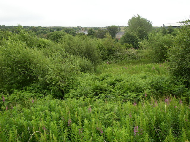
Disused millpond near Low Westwood, Golcar
The vegetation in the foreground is on the bed of the millpond (for Westwood Mill), which was contained between the retaining wall for the canal towpath and an embankment, beyond which a narrow field slopes down to the River Colne. In the distance the square tower of the mill in Linthwaite can just be seen, a little below the horizon and slightly left of centre.
 Map © Crown Copyright")
TIP: Click the map for more Large scale mapping
- Grid Square
- SE0914, 132 images (more nearby 🔍)
- Photographer
- Humphrey Bolton (more nearby)
- Date Taken
- Thursday, 12 July, 2007 (more nearby)
- Submitted
- Thursday, 12 July, 2007
- Subject Location
-
OSGB36:
 SE 094 145 [100m precision]
WGS84: 53:37.6170N 1:51.5606W - Camera Location
-
OSGB36: SE 094 145
- View Direction
- South-southeast (about 157 degrees)