2016
SE0025 : Broad Bottom Farm, Mytholmroyd
taken 8 years ago, near to Mytholmroyd, Calderdale, England
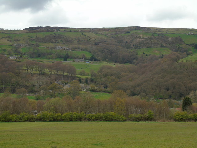
Broad Bottom Farm, Mytholmroyd
Taken on southern perimeter of the playing fields at Great Stubb, Mytholmroyd, West Yorkshire, I am looking across the River Calder and the Rochdale Canal to Broad Bottom Farm and Redacre Wood to the east and Hill House Wood running up along Hill House Clough to Hill House Brink and Brink Top above.
 Map © Crown Copyright")
TIP: Click the map for more Large scale mapping
- Grid Square
- SE0025, 262 images (more nearby 🔍)
- Photographer
- Carroll Pierce (more nearby)
- Date Taken
- Thursday, 28 April, 2016 (more nearby)
- Submitted
- Sunday, 1 May, 2016
- Subject Location
-
OSGB36:
 SE 0053 2599 [10m precision]
WGS84: 53:43.8183N 1:59.6067W - Camera Location
-
OSGB36: SE 0051 2596
- View Direction
- North-northeast (about 22 degrees)