2016
TQ4871 : London Loop Walk No. 2, Bexley, Kent
taken 8 years ago, near to North Cray, Bexley, England
This is 1 of 8 images, with title London Loop Walk No. 2, Bexley, Kent in this square
London Loop Walk No. 2, Bexley, Kent
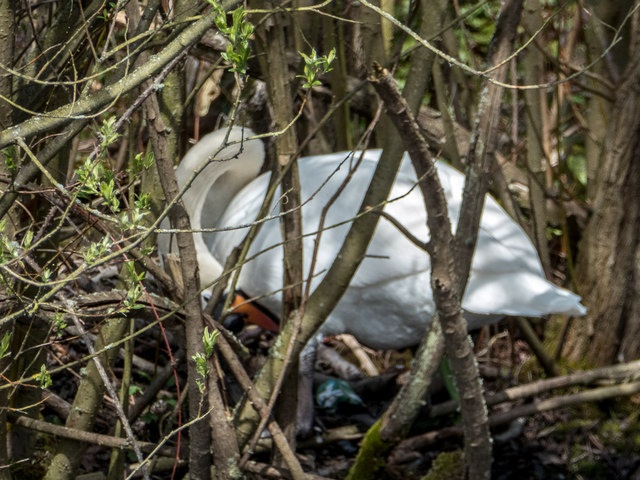
Here we are beside the River Cray having just passed the five arch bridge. On the river bank a mute swan was incubating her eggs.
London Outer Orbital Path (LOOP)
Starting at the Thames at Erith and finishing on the opposite north bank at Coldharbour, the Loop (London Outer Orbital Path) is 150 miles long, passing through numerous woods, commons and parks and on waterside paths alongside the Grand Union Canal and London rivers such as the Colne, Crane, Cray, Darent and Ingrebourne.
 Map © Crown Copyright")
TIP: Click the map for more Large scale mapping
- Grid Square
- TQ4871, 92 images (more nearby 🔍)
- Photographer
- Christine Matthews (more nearby)
- Date Taken
- Tuesday, 26 April, 2016 (more nearby)
- Submitted
- Tuesday, 3 May, 2016
- Subject Location
-
OSGB36:
 TQ 4812 7181 [10m precision]
WGS84: 51:25.5568N 0:7.7465E - Camera Location
-
OSGB36: TQ 4816 7176
- View Direction
- Northwest (about 315 degrees)