2016
SE0676 : Scar House Reservoir not overflowing
taken 8 years ago, 3 km from Middlesmoor, North Yorkshire, England
This is 1 of 2 images, with title starting with Scar in this square
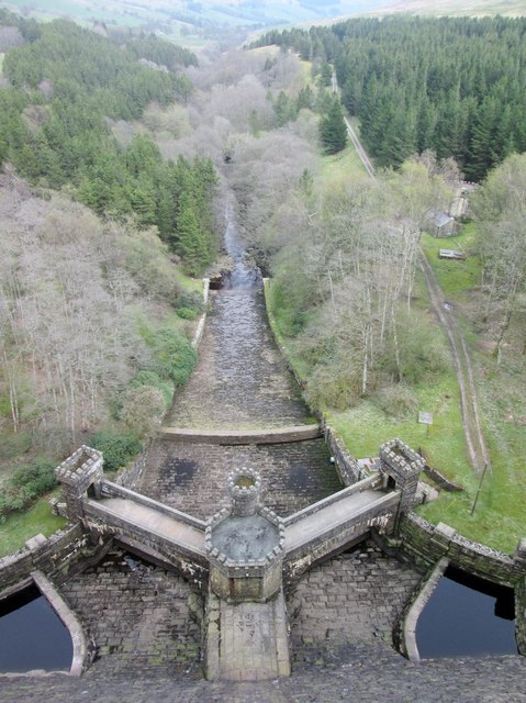
Scar House Reservoir not overflowing
The spillway down to the River Nidd is dry.The Nidderdale Way crosses the dam
 Map © Crown Copyright")
TIP: Click the map for more Large scale mapping
- Grid Square
- SE0676, 93 images (more nearby 🔍)
- Photographer
- Martin Dawes (more nearby)
- Date Taken
- Friday, 6 May, 2016 (more nearby)
- Submitted
- Tuesday, 10 May, 2016
- Subject Location
-
OSGB36:
 SE 0671 7688 [10m precision]
WGS84: 54:11.2589N 1:53.9203W - Camera Location
-
OSGB36: SE 0668 7688
- View Direction
- EAST (about 90 degrees)