2016
NH6603 : Old landslip?
taken 8 years ago, near to Geal Charn [hill or Mountain], Highland, Great Britain
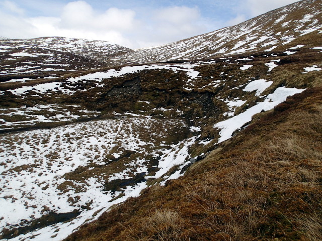
Old landslip?
A strange geographical feature - the high river banks hereabouts have a large semicircular slice removed, about 20-30m deep and 80-100m across. Could it be a kettle?
 Map © Crown Copyright")
TIP: Click the map for more Large scale mapping
- Grid Square
- NH6603, 5 images (more nearby 🔍)
- Photographer
- Chris Eilbeck (more nearby)
- Date Taken
- Sunday, 1 May, 2016 (more nearby)
- Submitted
- Tuesday, 10 May, 2016
- Subject Location
-
OSGB36:
 NH 6633 0351 [10m precision]
WGS84: 57:6.1843N 4:12.4981W - Camera Location
-
OSGB36: NH 66329 03478
- View Direction
- NORTH (about 0 degrees)