2016
NT0217 : Clyde Law Wind Farm
taken 8 years ago, 5 km N of Nether Howecleuch, Dumfries And Galloway, Scotland
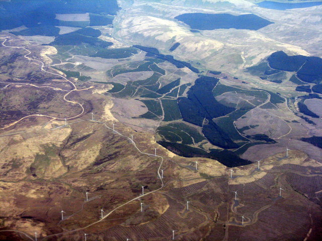
Clyde Law Wind Farm
Looking northeast to forestry on the western side of upper Tweeddale, which runs diagonally from mid-right to upper left.
 Map © Crown Copyright")
TIP: Click the map for more Large scale mapping
- Grid Square
- NT0217, 19 images (more nearby 🔍)
- Photographer
- M J Richardson (more nearby)
- Date Taken
- Wednesday, 11 May, 2016 (more nearby)
- Submitted
- Thursday, 12 May, 2016
- Subject Location
-
OSGB36:
 NT 025 175 [100m precision]
WGS84: 55:26.4980N 3:32.5641W - Camera Location
-
OSGB36: NS 973 133
- View Direction
- Northeast (about 45 degrees)