2016
TQ1811 : Southdown Terrace, Steyning
taken 8 years ago, near to Steyning, West Sussex, England
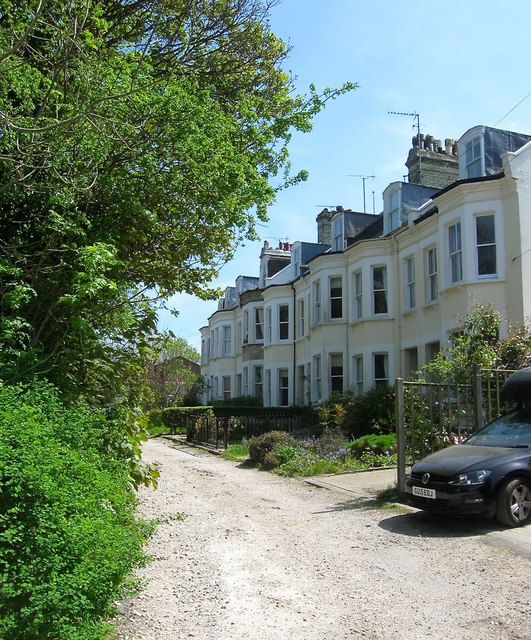
Southdown Terrace, Steyning
A cul de sac off Station Road that was built in the 1870s. The road originally ended at the Railway Hotel which was later demolished.
 Map © Crown Copyright")
TIP: Click the map for more Large scale mapping
- Grid Square
- TQ1811, 123 images (more nearby 🔍)
- Photographer
- Simon Carey (more nearby)
- Date Taken
- Sunday, 8 May, 2016 (more nearby)
- Submitted
- Saturday, 14 May, 2016
- Subject Location
-
OSGB36:
 TQ 1810 1132 [10m precision]
WGS84: 50:53.3582N 0:19.3379W - Camera Location
-
OSGB36: TQ 1806 1133
- View Direction
- East-southeast (about 112 degrees)