2007
ND3765 : Ruined croft beside A99
taken 17 years ago, near to Milltown, Highland, Scotland
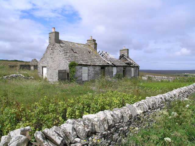
Ruined croft beside A99
The grid line between squares ND3765 and ND3766 passes right through this building, which is perhaps what did all the damage?! The good bit is in ND3765.
 Map © Crown Copyright")
TIP: Click the map for more Large scale mapping
- Grid Square
- ND3765, 9 images (more nearby 🔍)
- Photographer
- Richard Paxman (more nearby)
- Date Taken
- Wednesday, 11 July, 2007 (more nearby)
- Submitted
- Sunday, 15 July, 2007
- Subject Location
-
OSGB36:
 ND 376 659 [100m precision]
WGS84: 58:34.6405N 3:4.4308W - Camera Location
-
OSGB36: ND 377 659
- View Direction
- West-northwest (about 292 degrees)