2007
TA0928 : Ferensway and St Stephens development
taken 17 years ago, near to Kingston Upon Hull, England
This is 1 of 63 images, with title starting with Ferensway in this square
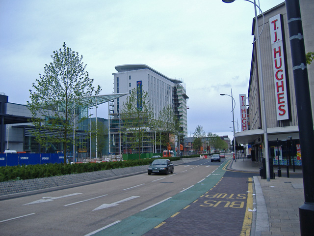
Ferensway and St Stephens development
To see the redevelopment of the area at an earlier stage, see TA0928 : St Stephen's - MORE than just a retail destination
 Map © Crown Copyright")
TIP: Click the map for more Large scale mapping
- Grid Square
- TA0928, 6574 images (more nearby 🔍)
- Photographer
- Paul Harrop (more nearby)
- Date Taken
- Sunday, 15 July, 2007 (more nearby)
- Submitted
- Sunday, 15 July, 2007
- Subject Location
-
OSGB36:
 TA 092 289 [100m precision]
WGS84: 53:44.7026N 0:20.7205W - Camera Location
-
OSGB36: TA 092 288
- View Direction
- North-northwest (about 337 degrees)