2005
SD5858 : Ward's Stone
taken 19 years ago, 3 km from Tarnbrook, Lancashire, England
This is 1 of 5 images, with title Ward's Stone in this square
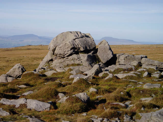
Ward's Stone
This tor is probably the highest point in the Forest of Bowland (though the other end of Ward's Stone's summit plateau provides some competition). It's also the highest hill wholly in Lancashire, according to its present-day boundaries. Ingleborough is the prominent hill on the right-hand side.
 Map © Crown Copyright")
TIP: Click the map for more Large scale mapping
- Grid Square
- SD5858, 52 images (more nearby 🔍)
- Photographer
- David Gruar (more nearby)
- Date Taken
- Thursday, 1 September, 2005 (more nearby)
- Submitted
- Monday, 5 September, 2005
- Subject Location
-
OSGB36:
 SD 585 585 [100m precision]
WGS84: 54:1.2494N 2:38.0940W