2016
TL5325 : Foot crossing over the railway at Fullers End, near Elsenham
taken 8 years ago, near to Elsenham, Essex, England
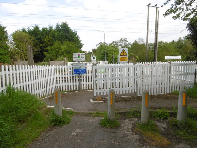
Foot crossing over the railway at Fullers End, near Elsenham
The railway line to Cambridge was opened by the Eastern Counties Railway on 30th July 1845. Robin Hood Road to the west of the railway presumably once linked up with Tye Green Road to the east of it. Now it is just a foot crossing known as Fullers End Footpath Crossing. This view is from Robin Hood Road.
 Map © Crown Copyright")
TIP: Click the map for more Large scale mapping
- Grid Square
- TL5325, 17 images (more nearby 🔍)
- Photographer
- Marathon (more nearby)
- Date Taken
- Saturday, 14 May, 2016 (more nearby)
- Submitted
- Monday, 16 May, 2016
- Subject Location
-
OSGB36:
 TL 5346 2594 [10m precision]
WGS84: 51:54.6514N 0:13.7767E - Camera Location
-
OSGB36: TL 5345 2596
- View Direction
- South-southeast (about 157 degrees)