2016
SK1371 : The Waterloo public house
taken 8 years ago, near to Blackwell, Derbyshire, England
This is 1 of 5 images, with title starting with The Waterloo in this square
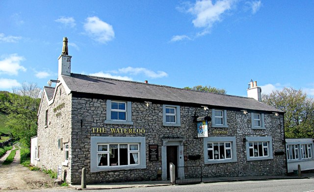
The Waterloo public house.
The Limestone Way footpath follows the lane to the left.
 Map © Crown Copyright")
TIP: Click the map for more Large scale mapping
- Grid Square
- SK1371, 60 images (more nearby 🔍)
- Photographer
- steven ruffles (more nearby)
- Date Taken
- Saturday, 14 May, 2016 (more nearby)
- Submitted
- Wednesday, 18 May, 2016
- Subject Location
-
OSGB36:
 SK 1320 7139 [10m precision]
WGS84: 53:14.3626N 1:48.2207W - Camera Location
-
OSGB36: SK 1321 7141
- View Direction
- South-southwest (about 202 degrees)