2007
SO8282 : Meeting of ways
taken 17 years ago, near to Kingsford, Worcestershire, England
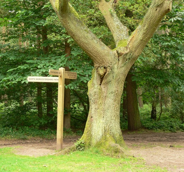
Meeting of ways
The meeting of the Staffordshire Way and the North Worcestershire Path inside the Kingsford Forest Park.
The Staffordshire Way
The Staffordshire Way is a 92 miles (148 km) long-distance path. It starts at Mow Cop Castle on the edge of the Peak District in North Staffordshire, and ends at Kinver Edge in South Staffordshire. The path connects with the North Worcestershire Path and the Worcestershire Way at Kinver Edge, the Heart of England Way at Cannock Chase, the Limestone Way at Rocester and the Gritstone Trail in north Staffordshire.
The North Worcestershire Path
The North Worcestershire Path runs 37 miles (60 km) from Bewdley to Major's Green in the county of Worcestershire.
 Map © Crown Copyright")
TIP: Click the map for more Large scale mapping
- Grid Square
- SO8282, 73 images (more nearby 🔍)
- Photographer
- Mat Fascione (more nearby)
- Date Taken
- Wednesday, 11 July, 2007 (more nearby)
- Submitted
- Sunday, 15 July, 2007
- Subject Location
-
OSGB36:
 SO 829 822 [100m precision]
WGS84: 52:26.2555N 2:15.1781W - Camera Location
-
OSGB36: SO 829 822
- View Direction
- Southeast (about 135 degrees)