2016
TQ1711 : Site of Gatewick Mill Pond, Steyning
taken 8 years ago, near to Steyning, West Sussex, England
Site of Gatewick Mill Pond, Steyning
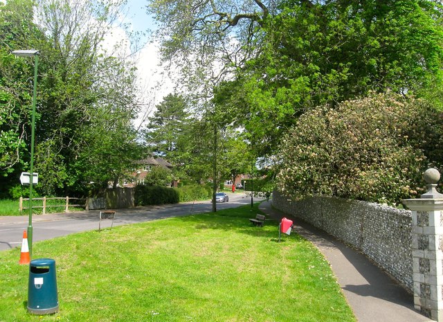
Looking along the boundary wall of Gatewick House towards the bridge over Tanyard Stream. There had been a mill at this location since at least the 13th century and survived until 1878 when it was demolished. The mill pond was filled in and is now the location of the entrance to Shooting Field estate.
 Map © Crown Copyright")
TIP: Click the map for more Large scale mapping
- Grid Square
- TQ1711, 573 images (more nearby 🔍)
- Photographer
- Simon Carey (more nearby)
- Date Taken
- Sunday, 15 May, 2016 (more nearby)
- Submitted
- Saturday, 21 May, 2016
- Subject Location
-
OSGB36:
 TQ 1782 1145 [10m precision]
WGS84: 50:53.4317N 0:19.5741W - Camera Location
-
OSGB36: TQ 1784 1142
- View Direction
- North-northwest (about 337 degrees)