2016
NN0585 : Nearing the end of the wall
taken 8 years ago, near to Druim Gleann Laoigh [hill or Mountain], Highland, Great Britain
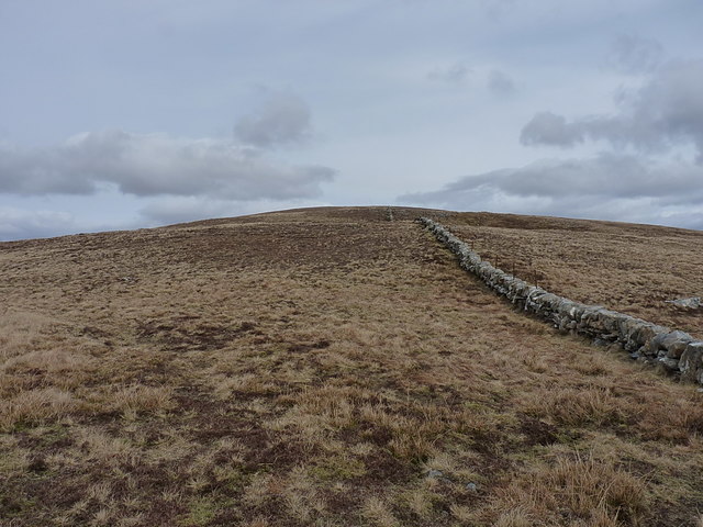
Nearing the end of the wall
The boundary that starts in NN0385 runs as a drystane dyke for roughly a couple of miles, which appears to end shortly after this point; the boundary then continues as a decrepit fence over the moors.
 Map © Crown Copyright")
TIP: Click the map for more Large scale mapping
- Grid Square
- NN0585, 7 images (more nearby 🔍)
- Photographer
- Richard Law (more nearby)
- Date Taken
- Saturday, 23 April, 2016 (more nearby)
- Submitted
- Monday, 23 May, 2016
- Subject Location
-
OSGB36:
 NN 0574 8516 [10m precision]
WGS84: 56:55.0138N 5:11.5737W - Camera Location
-
OSGB36: NN 05704 85142
- View Direction
- East-northeast (about 67 degrees)