2016
NN0787 : Folded rocks in the burn
taken 8 years ago, near to River Mallie [water Feature], Highland, Great Britain
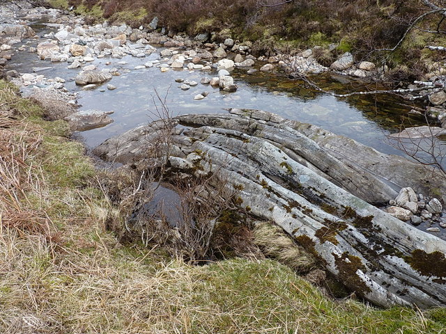
Folded rocks in the burn
The cut-off cross section of a steeply dipped anticline, showing clearly in the bed of the burn.
 Map © Crown Copyright")
TIP: Click the map for more Large scale mapping
- Grid Square
- NN0787, 19 images (more nearby 🔍)
- Photographer
- Richard Law (more nearby)
- Date Taken
- Saturday, 23 April, 2016 (more nearby)
- Submitted
- Monday, 23 May, 2016
- Subject Location
-
OSGB36:
 NN 0719 8716 [10m precision]
WGS84: 56:56.1265N 5:10.2383W - Camera Location
-
OSGB36: NN 07176 87160
- View Direction
- EAST (about 90 degrees)