2016
NS2604 : Kirk Hill View
taken 8 years ago, near to Wallacetown, South Ayrshire, Scotland
This is 1 of 2 images, with title Kirk Hill View in this square
Kirk Hill View
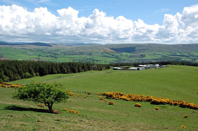
The Girvan Valley viewed from the southern slope of Kirk Hill. High Mains farm lies in the foreground, then the village of Dailly before the start of the Southern Uplands.
 Map © Crown Copyright")
TIP: Click the map for more Large scale mapping
- Grid Square
- NS2604, 19 images (more nearby 🔍)
- Photographer
- Mary and Angus Hogg (more nearby)
- Date Taken
- Sunday, 22 May, 2016 (more nearby)
- Submitted
- Monday, 23 May, 2016
- Subject Location
-
OSGB36:
 NS 2657 0423 [10m precision]
WGS84: 55:18.0916N 4:44.0118W - Camera Location
-
OSGB36: NS 2657 0423
- View Direction
- SOUTH (about 180 degrees)