2007
SZ4786 : Towards Bowcombe Farm
taken 17 years ago, near to Bowcombe, Isle of Wight, England
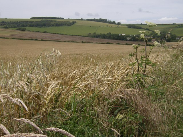
Towards Bowcombe Farm
A bridleway runs south-east to north-west towards Bowcombe Farm which can be seen behind the cow parsley. This square is mainly flat arable farmland with large fields, with the wheat in this one growing well.
 Map © Crown Copyright")
TIP: Click the map for more Large scale mapping
- Grid Square
- SZ4786, 13 images (more nearby 🔍)
- Photographer
- Graham Horn (more nearby)
- Date Taken
- Saturday, 14 July, 2007 (more nearby)
- Submitted
- Monday, 16 July, 2007
- Subject Location
-
OSGB36:
 SZ 473 862 [100m precision]
WGS84: 50:40.4342N 1:19.8593W - Camera Location
-
OSGB36: SZ 476 861
- View Direction
- West-northwest (about 292 degrees)