2016
NT3017 : Cacrabank
taken 8 years ago, near to Cacrabank, Scottish Borders, Scotland
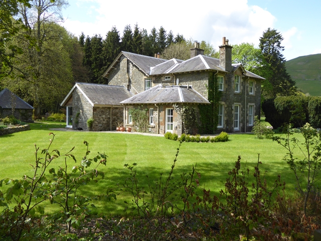
Cacrabank
Country house at the lower end of the valley of the Rankle Burn.
 Map © Crown Copyright")
TIP: Click the map for more Large scale mapping
- Grid Square
- NT3017, 27 images (more nearby 🔍)
- Photographer
- Oliver Dixon (more nearby)
- Date Taken
- Monday, 23 May, 2016 (more nearby)
- Submitted
- Wednesday, 25 May, 2016
- Subject Location
-
OSGB36:
 NT 3063 1708 [10m precision]
WGS84: 55:26.5595N 3:5.8853W - Camera Location
-
OSGB36: NT 30677 17102
- View Direction
- West-southwest (about 247 degrees)