2016
NT3914 : Track to the water's edge
taken 8 years ago, near to Borthwickbrae, Scottish Borders, Scotland
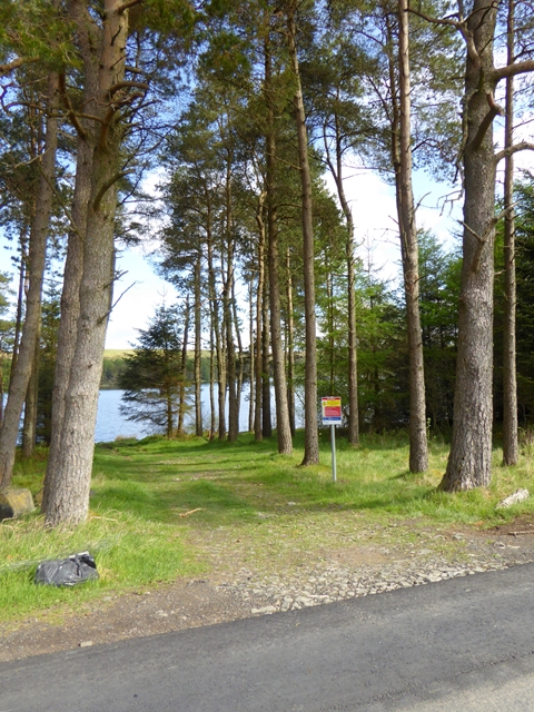
Track to the water's edge
A short track leading through the trees from the B711 to the south shore of Alemoor Reservoir. The notice cheerily informs us that "Deaths have occurred at reservoirs".
 Map © Crown Copyright")
TIP: Click the map for more Large scale mapping
- Grid Square
- NT3914, 22 images (more nearby 🔍)
- Photographer
- Oliver Dixon (more nearby)
- Date Taken
- Monday, 23 May, 2016 (more nearby)
- Submitted
- Thursday, 26 May, 2016
- Subject Location
-
OSGB36:
 NT 3994 1495 [10m precision]
WGS84: 55:25.4853N 2:57.0294W - Camera Location
-
OSGB36: NT 39959 14921
- View Direction
- North-northwest (about 337 degrees)