2007
SD9012 : Well i' th' Lane Bridge over the Rochdale Canal
taken 17 years ago, near to Rochdale, England
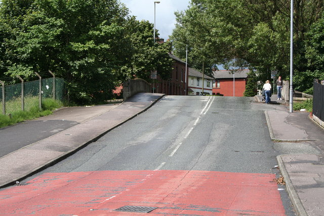
Well i' th' Lane Bridge over the Rochdale Canal.
This shows the top of this bridge, which not only bridges the canal, but is the point at which the road-name changes from Well i' th' Lane (where the photographer is standing) to Milkstone Road, on the other side. In popular terms, it also marks the boundary of Deeplish, the district name of the area on the north side of the bridge. Whether it is actually a ward boundary, I am unable to say.
 Map © Crown Copyright")
TIP: Click the map for more Large scale mapping
- Grid Square
- SD9012, 165 images (more nearby 🔍)
- Photographer
- Dr Neil Clifton (more nearby)
- Date Taken
- Monday, 9 July, 2007 (more nearby)
- Submitted
- Monday, 16 July, 2007
- Subject Location
-
OSGB36:
 SD 901 121 [100m precision]
WGS84: 53:36.3220N 2:9.0109W - Camera Location
-
OSGB36: SD 902 120
- View Direction
- Northwest (about 315 degrees)