2007
NT6717 : Cauldside Clump
taken 17 years ago, near to Mossburnford, Scottish Borders, Scotland
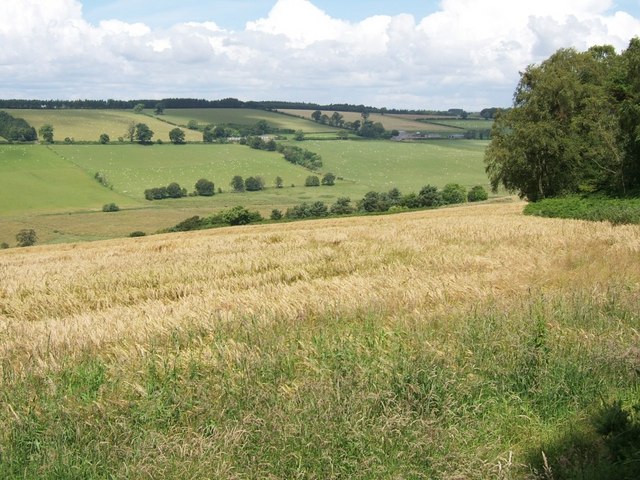
Cauldside Clump
The name is applied to the small piece of woodland in the middle distance. The trees appear to be newer than the wood, as the name appears on older maps. The trees on the right form the edge of 'Burnt Wood'! Scraesburgh Farm cam be seen in the distance.
 Map © Crown Copyright")
TIP: Click the map for more Large scale mapping
- Grid Square
- NT6717, 6 images (more nearby 🔍)
- Photographer
- Richard Warren (more nearby)
- Date Taken
- Tuesday, 17 July, 2007 (more nearby)
- Submitted
- Tuesday, 17 July, 2007
- Subject Location
-
OSGB36:
 NT 678 173 [100m precision]
WGS84: 55:26.9423N 2:30.6274W - Camera Location
-
OSGB36: NT 678 170
- View Direction
- North-northwest (about 337 degrees)