2016
SJ1963 : Mold boundary stone in Coed Pwll-y-blawdd
taken 8 years ago, near to Cadole, Flintshire/Sir y Fflint, Wales
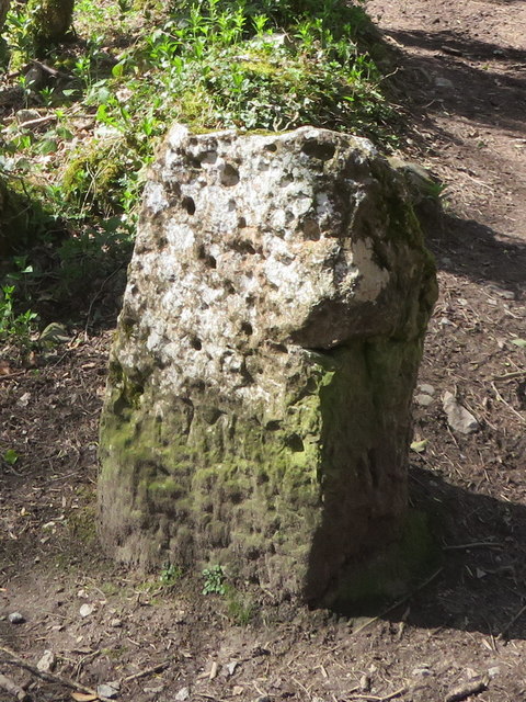
Mold boundary stone in Coed Pwll-y-blawdd
This old boundary stone is at a fork in the paths in the woods in Loggerheads Country Park, parish of Mold (Flintshire District). The stone is marked on old maps, and there is an 'M' carved into the green lower part of the stone.
Milestone Society National ID: FLT_MOLD01pb
Milestone Society National ID: FLT_MOLD01pb
National Survey of Wayside Features by The Milestone Society
These images are from Link
 Map © Crown Copyright")
TIP: Click the map for more Large scale mapping
- Grid Square
- SJ1963, 21 images (more nearby 🔍)
- Photographer
- John S Turner (more nearby)
- Date Taken
- Wednesday, 4 May, 2016 (more nearby)
- Submitted
- Tuesday, 31 May, 2016
- Subject Location
-
OSGB36:
 SJ 1969 6304 [10m precision]
WGS84: 53:9.5045N 3:12.1518W - Camera Location
-
OSGB36: SJ 1969 6304
- View Direction
- West-northwest (about 292 degrees)