2005
NN9299 : Coire Dhondail path, Braeriach
taken 19 years ago, near to Coire Nan Clach [hill or Mountain], Highland, Great Britain
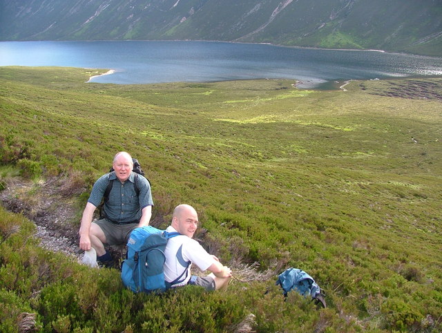
Coire Dhondail path, Braeriach
This was taken near where the Coire Dhondail path meets the main Loch Einich track. It was the end of a long day's cycle run and walk from Coylumbridge to the top of Sgor an Lochain Uaine (Angel's Peak) and Cairn Toul.
 Map © Crown Copyright")
TIP: Click the map for more Large scale mapping
- Grid Square
- NN9299, 4 images (more nearby 🔍)
- Photographer
- Michael G Gaffney (more nearby)
- Date Taken
- Monday, 4 July, 2005 (more nearby)
- Submitted
- Tuesday, 17 July, 2007
- Subject Location
-
OSGB36:
 NN 921 997 [100m precision]
WGS84: 57:4.5867N 3:46.8727W - Camera Location
-
OSGB36: NN 922 998
- View Direction
- West-southwest (about 247 degrees)