2016
SP0315 : The Mill Inn, Withington
taken 8 years ago, near to Withington, Gloucestershire, England
This is 1 of 10 images, with title The Mill Inn, Withington in this square
The Mill Inn, Withington
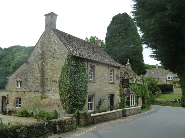
A three-quarter view of The Mill Inn at Withington looking at its western façade. As the inn is situated within the angle of a 90° bend in the main street through Withington, it has a road frontage to both the west and south.
See also SP0315 : The Mill Inn, Withington from its garden and shared description below:
See also SP0315 : The Mill Inn, Withington from its garden and shared description below:
The Mill Inn, Withington
The Mill Inn in the Cotswold village of Withington dates back around 300 years to the early C18th. It was enlarged later in the same century, and then substantial extensions were added at the rear c.1960 by D. Stratton Davis.
The pub has a number of rooms of various sizes, from quite large to little nooks, all connected by corridors and low doorways, making it a very interesting old hostelry.
Unusually for the area, it is owned by the Yorkshire brewery of Sam Smiths of Tadcaster Link
It is claimed that the 60s & 70s pub grub favourite "Chicken in a Basket" originated at this pub, and a few years ago it returned to their menu and can still be enjoyed there today [as at June 2016].
The inn is Grade II listed by English Heritage Link
 Map © Crown Copyright")
TIP: Click the map for more Large scale mapping
- Grid Square
- SP0315, 58 images (more nearby 🔍)
- Photographer
- Rob Farrow (more nearby)
- Date Taken
- Monday, 30 May, 2016 (more nearby)
- Submitted
- Thursday, 9 June, 2016
- Subject Location
-
OSGB36:
 SP 0318 1538 [10m precision]
WGS84: 51:50.2212N 1:57.3151W - Camera Location
-
OSGB36: SP 0316 1539
- View Direction
- East-southeast (about 112 degrees)