2016
SX5692 : Meldon Viaduct
taken 8 years ago, near to Meldon, Devon, England
This is 1 of 25 images, with title Meldon Viaduct in this square
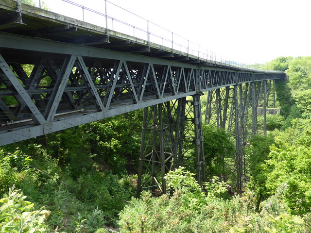
Meldon Viaduct
This is a cast and wrought iron truss viaduct that is 535 feet long and rises 151 feet above the valley. It opened in 1874 and was doubled in 1878. The line closed to passengers in 1968 and was used afterwards for shunting freight trains associated with Meldon Quarry. The lines were lifted in 1990 and the viaduct was refurbished in 1996 as part of the Granite Way. It has been mooted as part of an alternative route to the seafront railway at Dawlish but it is claimed the viaduct would need replacing to carry modern traffic.
 Map © Crown Copyright")
TIP: Click the map for more Large scale mapping
- Grid Square
- SX5692, 172 images (more nearby 🔍)
- Photographer
- Chris Allen (more nearby)
- Date Taken
- Sunday, 29 May, 2016 (more nearby)
- Submitted
- Sunday, 12 June, 2016
- Subject Location
-
OSGB36:
 SX 5650 9237 [10m precision]
WGS84: 50:42.7920N 4:2.0358W - Camera Location
-
OSGB36: SX 5652 9240
- View Direction
- Southwest (about 225 degrees)