2016
TL9907 : Bradwell Creek and Pewet Island
taken 8 years ago, near to Bradwell Waterside, Essex, England
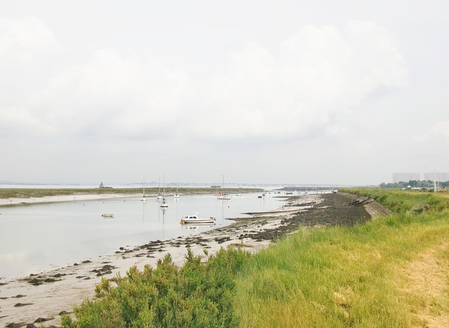
Bradwell Creek and Pewet Island
Pewet Island is little more than a strip of salt-marsh off-shore. Bradwell Creek is a long, narrow lagoon used as moorings, and open to the tides at either end.
Photo taken from the seawall, south-west of Bradwell Marina. The old nuclear power-station can be seen in the distance, at the right-hand margin of the picture.
Photo taken from the seawall, south-west of Bradwell Marina. The old nuclear power-station can be seen in the distance, at the right-hand margin of the picture.
 Map © Crown Copyright")
TIP: Click the map for more Large scale mapping
- Grid Square
- TL9907, 31 images (more nearby 🔍)
- Photographer
- Stefan Czapski (more nearby)
- Date Taken
- Saturday, 11 June, 2016 (more nearby)
- Submitted
- Monday, 13 June, 2016
- Subject Location
-
OSGB36:
 TL 9917 0788 [10m precision]
WGS84: 51:44.0540N 0:52.9778E - Camera Location
-
OSGB36: TL 9904 0750
- View Direction
- North-northeast (about 22 degrees)