2016
NJ9307 : The Gibberie Wallie
taken 8 years ago, near to Old Aberdeen, Aberdeen, Scotland
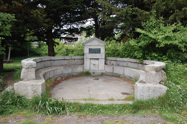
The Gibberie Wallie
This strange name possibly refers to a 17th Century 'gingerbread well (or wall)' although the structure itself only dates from 1937.
 Map © Crown Copyright")
TIP: Click the map for more Large scale mapping
- Grid Square
- NJ9307, 185 images (more nearby 🔍)
- Photographer
- Bill Harrison (more nearby)
- Date Taken
- Sunday, 12 June, 2016 (more nearby)
- Submitted
- Friday, 17 June, 2016
- Subject Location
-
OSGB36:
 NJ 9373 0792 [10m precision]
WGS84: 57:9.7257N 2:6.3179W - Camera Location
-
OSGB36: NJ 9374 0792
- View Direction
- WEST (about 270 degrees)