2005
TL2089 : Holme Fen Post, Cambs
taken 19 years ago, near to Holme, Cambridgeshire, England
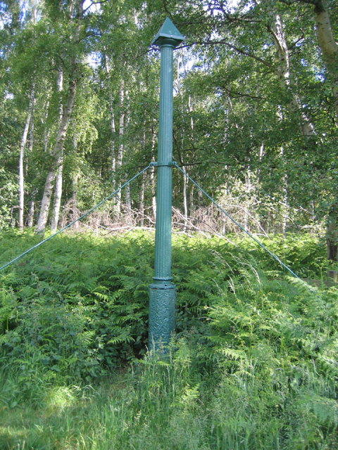
Holme Fen Post, Cambs
The original Holme Post was sunk into the clay substrate with the top flush with the peatland surface in 1851; now 4 metres are exposed following drainage and wastage of the peat. The reclaimed farmland was abandoned to birch woodland a century ago.
 Map © Crown Copyright")
TIP: Click the map for more Large scale mapping
- Grid Square
- TL2089, 42 images (more nearby 🔍)
- Photographer
- Rodney Burton (more nearby)
- Date Taken
- Tuesday, 14 June, 2005 (more nearby)
- Submitted
- Tuesday, 6 September, 2005
- Subject Location
-
OSGB36:
 TL 202 893 [100m precision]
WGS84: 52:29.3030N 0:13.8710W