2015
NT4884 : The Red House
taken 8 years ago, near to Gullane, East Lothian, Scotland
This is 1 of 2 images, with title The Red House in this square
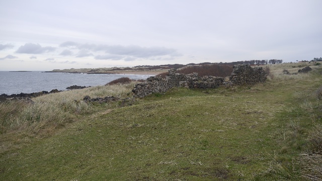
The Red House
Ruins on the links east of Gullane. The building is named on 19th century maps.
 Map © Crown Copyright")
TIP: Click the map for more Large scale mapping
- Grid Square
- NT4884, 115 images (more nearby 🔍)
- Photographer
- Richard Webb (more nearby)
- Date Taken
- Friday, 25 December, 2015 (more nearby)
- Submitted
- Thursday, 23 June, 2016
- Subject Location
-
OSGB36:
 NT 4839 8458 [10m precision]
WGS84: 56:3.0771N 2:49.8105W - Camera Location
-
OSGB36: NT 4837 8456
- View Direction
- Northeast (about 45 degrees)