2016
SZ0990 : Bournemouth: footpath C23 approaches the clifftop
taken 8 years ago, near to Bournemouth, Bournemouth, Christchurch & Poole, England
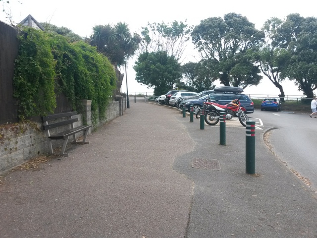
Bournemouth: footpath C23 approaches the clifftop
Looking along the southern half of SZ0990 : Bournemouth: footpath C23 from Bath Road as it heads for the East Overcliff path. See SZ0990 : Bournemouth: footpath C23 arrives on the cliff top for the next view on the path ahead.
Public rights of way in Bournemouth
A series of pictures documenting the public rights of way in the borough of Bournemouth. The pictures of the rights of way all have links to the next picture on the same route, in each direction.
The rights of way are all documented, in numerical order, in this article:
Link
 Map © Crown Copyright")
TIP: Click the map for more Large scale mapping
- Grid Square
- SZ0990, 459 images (more nearby 🔍)
- Photographer
- Chris Downer (more nearby)
- Date Taken
- Monday, 27 June, 2016 (more nearby)
- Submitted
- Monday, 27 June, 2016
- Subject Location
-
OSGB36:
 SZ 0910 9082 [10m precision]
WGS84: 50:43.0163N 1:52.3479W - Camera Location
-
OSGB36: SZ 0909 9084
- View Direction
- Southeast (about 135 degrees)