2016
NS3379 : Red Road at West Lodge
taken 8 years ago, near to Colgrain, Argyll And Bute, Scotland
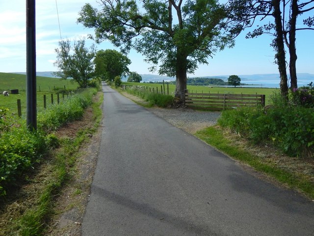
Red Road at West Lodge
The path shown in NS3379 : Approaching Red Road meets Red Road beside West Lodge. The present picture is a view of the road from that point, which is the western end of the core path.
Red Road itself leads downhill to meet the main road at NS32977911, almost opposite the point (NS32997905) where a road leads down to Ardmore Point.
Ardmore Point itself can be seen in this picture, just right of centre, as a wooded promontory, projecting out into the Firth of Clyde.
Red Road itself leads downhill to meet the main road at NS32977911, almost opposite the point (NS32997905) where a road leads down to Ardmore Point.
Ardmore Point itself can be seen in this picture, just right of centre, as a wooded promontory, projecting out into the Firth of Clyde.
Darleith Road to Red Road
This path between Darleith Road and Red Road is about a mile long. As of mid-2016, Argyll & Bute's Core Paths Plan (see Link
for the current online mapping) includes this route, designated Core Path C263(a): "Red Rd to Darleith Rd Lyleston to Kirkton".
 Map © Crown Copyright")
TIP: Click the map for more Large scale mapping
- Grid Square
- NS3379, 26 images (more nearby 🔍)
- Photographer
- Lairich Rig (more nearby)
- Date Taken
- Friday, 3 June, 2016 (more nearby)
- Submitted
- Monday, 27 June, 2016
- Subject Location
-
OSGB36:
 NS 3316 7930 [10m precision]
WGS84: 55:58.6561N 4:40.5248W - Camera Location
-
OSGB36: NS 3317 7932
- View Direction
- Southwest (about 225 degrees)