2016
SZ0796 : Kinson: footpath E51 should come out here
taken 8 years ago, near to Kinson, Bournemouth, Christchurch & Poole, England
Kinson: footpath E51 should come out here
A view to the immediate left of SZ0796 : Kinson: footpath E46 comes out on Hyde Road - it is the same end fence panel in both pictures.
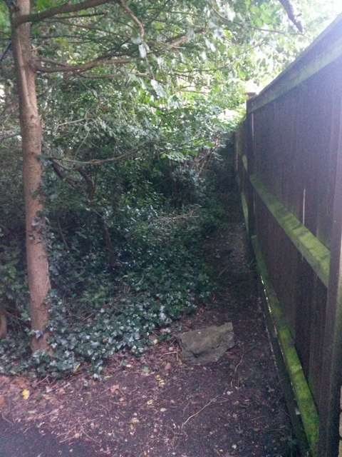
According to Bournemouth Borough Council's definitive map, footpath E51 from Aldridge Road should follow the course ahead of us. It is possible to walk through there but only as far as can be seen in the picture.
See SZ0796 : Kinson: footpath E51 should start about here for a picture at the other end - for more discussion on the path, a neighbouring path which may have superseded it in practice, and links to further pictures which illustrate the positions of the paths through the open space.
Another picture of the supposed course of the footpath, midway along as it crosses another path, is here: SZ0796 : Kinson: footpath E51 should cross footpath E34 approximately here
Public rights of way in Bournemouth
A series of pictures documenting the public rights of way in the borough of Bournemouth. The pictures of the rights of way all have links to the next picture on the same route, in each direction.
The rights of way are all documented, in numerical order, in this article:
Link
 Map © Crown Copyright")
TIP: Click the map for more Large scale mapping
- Grid Square
- SZ0796, 271 images (more nearby 🔍)
- Photographer
- Chris Downer (more nearby)
- Date Taken
- Tuesday, 28 June, 2016 (more nearby)
- Submitted
- Wednesday, 29 June, 2016
- Subject Location
-
OSGB36:
 SZ 0721 9624 [10m precision]
WGS84: 50:45.9423N 1:53.9479W - Camera Location
-
OSGB36: SZ 0720 9624
- View Direction
- East-southeast (about 112 degrees)