2016
TL1898 : East Coast Mainline south of Peterborough Station
taken 8 years ago, near to Peterborough, England
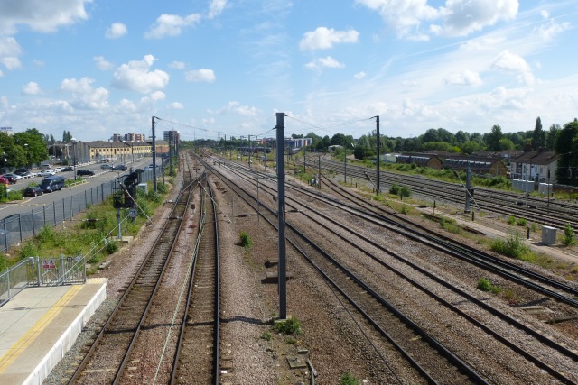
East Coast Mainline south of Peterborough Station
Looking up to London along the East Coast Mainline.
East Coast Main Line
The East Coast Main Line is a 393 mile long high speed electrified railway between London and Edinburgh, via Peterborough, Doncaster, York and Newcastle. It was constructed between 1846 & 1871 by several different rail companies.
Wikipedia: Link
 Map © Crown Copyright")
TIP: Click the map for more Large scale mapping
- Grid Square
- TL1898, 770 images (more nearby 🔍)
- Photographer
- DS Pugh (more nearby)
- Date Taken
- Sunday, 26 June, 2016 (more nearby)
- Submitted
- Sunday, 3 July, 2016
- Subject Location
-
OSGB36:
 TL 1875 9864 [10m precision]
WGS84: 52:34.3576N 0:14.9516W - Camera Location
-
OSGB36: TL 18746 98708
- View Direction
- SOUTH (about 180 degrees)