2016
NC4410 : Beinn Sgeireach wind assessment tower
taken 8 years ago, near to Allt Bad na t-Sagairt [water Feature], Highland, Great Britain
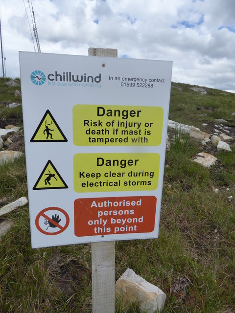
Beinn Sgeireach wind assessment tower
Information board explaining the hazards associated with the mast, but not the long term hazards of destroying the wilderness with wind farms
 Map © Crown Copyright")
TIP: Click the map for more Large scale mapping
- Grid Square
- NC4410, 7 images (more nearby 🔍)
- Photographer
- Mick Crawley (more nearby)
- Date Taken
- Wednesday, 22 June, 2016 (more nearby)
- Submitted
- Tuesday, 5 July, 2016
- Subject Location
-
OSGB36:
 NC 4440 1087 [10m precision]
WGS84: 58:3.5717N 4:38.3285W - Camera Location
-
OSGB36: NC 4448 1080
- View Direction
- Northwest (about 315 degrees)