2016
NZ1642 : Wood View, Hedleyhill Lane
taken 8 years ago, near to Quebec, County Durham, England
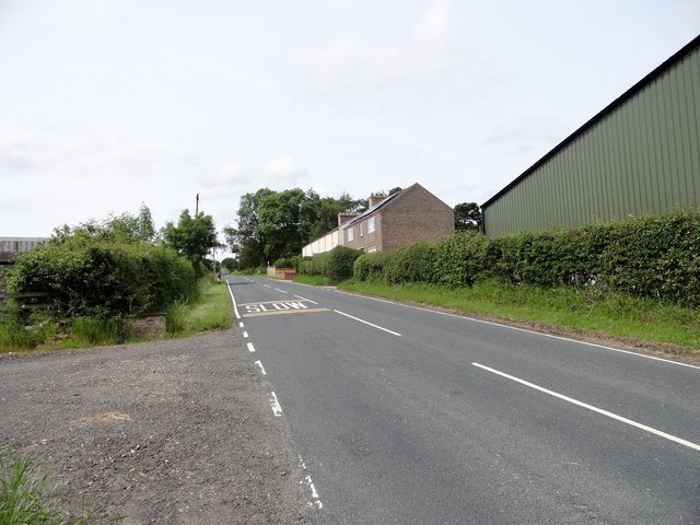
Wood View, Hedleyhill Lane
This isolated group of houses stands by the side of the road to Cornsay Colliery and Esh Winning. It is at the junction of a couple of country roads, which might explain its existence. There is a pub named the Fir Tree Inn here on the 1923 Ordnance Survey map, and the far white house is probably that building, now converted to a couple of private houses. The nearer, modern, house is probably the farmhouse for Hedleyhill Lane farm, also situated here.
 Map © Crown Copyright")
TIP: Click the map for more Large scale mapping
- Grid Square
- NZ1642, 15 images (more nearby 🔍)
- Photographer
- Robert Graham (more nearby)
- Date Taken
- Wednesday, 6 July, 2016 (more nearby)
- Submitted
- Saturday, 9 July, 2016
- Subject Location
-
OSGB36:
 NZ 1669 4247 [10m precision]
WGS84: 54:46.6122N 1:44.5235W - Camera Location
-
OSGB36: NZ 1677 4249
- View Direction
- West-southwest (about 247 degrees)