2007
SU6072 : Side passage, Bradfield
taken 17 years ago, near to Bradfield, West Berkshire, England
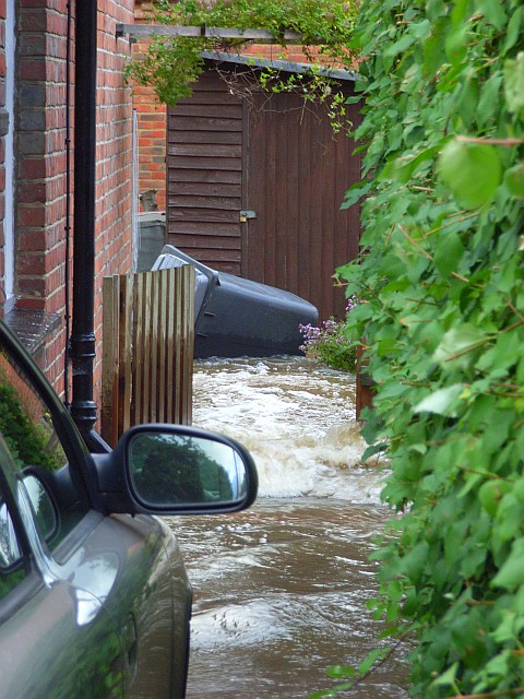
Side passage, Bradfield
Acting as a channel of the River Pang following a deluge earlier in the day. The tidemark on the gate shows the height that the water had reached during the flash flooding that followed the downpour (which had ceased about six hours earlier).
 Map © Crown Copyright")
TIP: Click the map for more Large scale mapping
- Grid Square
- SU6072, 59 images (more nearby 🔍)
- Photographer
- Andrew Smith (more nearby)
- Date Taken
- Friday, 20 July, 2007 (more nearby)
- Submitted
- Tuesday, 24 July, 2007
- Subject Location
-
OSGB36:
 SU 603 727 [100m precision]
WGS84: 51:27.0050N 1:8.0184W - Camera Location
-
OSGB36: SU 603 727
- View Direction
- Northeast (about 45 degrees)