2016
J1781 : Landing lights, Belfast International (Aldergrove) Airport (July 2016)
taken 8 years ago, 3 km from Killead, Co Antrim, Northern Ireland
Landing lights, Belfast International (Aldergrove) Airport (July 2016)
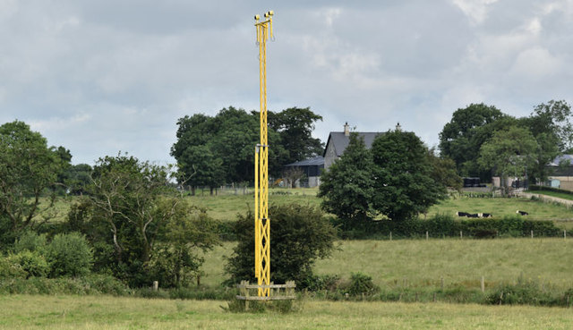
Landing lights, for runway 25, in a field on the eastern side of Drennans Road J1781 : Drennan's Road, Killead (July 2016).
Belfast International (Aldergrove) Airport
Commonly known as Aldergrove, Belfast International Airport opened as a military airfield in 1917. It became Belfasts civil airport in 1963 replacing that at Nutts Corner Link. Currently (July 2016) served by easyJet, Jet2, Ryanair, Thomas Cook, United Airlines and Wizz Air. There are numerous seasonal holiday charters to many European and trans-Atlantic destinations. This link is to the official website Link
and this to photographs at Belfast City Airport Link.
Loading map... (JavaScript required)
- Grid Square
- J1781, 47 images (more nearby 🔍)
- Photographer
- Albert Bridge (more nearby)
- Date Taken
- Thursday, 14 July, 2016 (more nearby)
- Submitted
- Thursday, 14 July, 2016
- Subject Location
-
Irish:
 J 171 812 [100m precision]
WGS84: 54:39.9447N 6:11.1083W - Camera Location
-
Irish: J 172 811
- View Direction
- North-northwest (about 337 degrees)