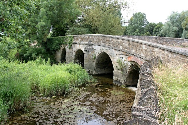
SK9800 : Duddington Bridge
taken 8 years ago, near to Duddington, North Northamptonshire, England
Listed buildings and structures are officially designated as being of special architectural, historical or cultural significance. There are over half a million listed structures in the United Kingdom, covered by around 375,000 listings.
Listed status is more commonly associated with buildings or groups of buildings, however it can cover many other structures, including bridges, headstones, steps, ponds, monuments, walls, phone boxes, wrecks, parks, and heritage sites, and in more recent times a road crossing (Abbey Road) and graffiti art (Banksy 'Spy-booth') have been included.
In England and Wales there are three main listing designations;
Grade I (2.5%) - exceptional interest, sometimes considered to be internationally important.
Grade II* (5.5%) - particularly important buildings of more than special interest.
Grade II (92%) - nationally important and of special interest.
There are also locally listed structures (at the discretion of local authorities) using A, B and C designations.
In Scotland three classifications are also used but the criteria are different. There are around 47,500 Listed buildings.
Category A (8%)- generally equivalent to Grade I and II* in England and Wales
Category B (51%)- this appears generally to cover the ground of Grade II, recognising national importance.
Category C (41%)- buildings of local importance, probably with some overlap with English Grade II.
In Northern Ireland the criteria are similar to Scotland, but the classifications are:
Grade A (2.3%)
Grade B+ (4.7%)
Grade B (93%)
Read more at Wikipedia Link
The River Welland is a river in the east of England, some 65 miles long. It rises in the Hothorpe Hills, at Sibbertoft in Northamptonshire, then flows generally northeast to Market Harborough, Stamford and Spalding, to reach The Wash near Fosdyke. For much of its length it forms the county boundary between Northamptonshire and Leicestershire, Rutland, Lincolnshire and Cambridgeshire. It is a major waterway across the part of The Fens called South Holland, and is one of the Fenland rivers which were laid out with washlands. There are two channels between widely-spaced embankments with the intention that flood waters would have space in which to spread while the tide in the estuary prevented free egress. However, after the floods of 1947, new works such as the Coronation Channel were constructed to control flooding in Spalding and the washes are no longer used solely as pasture, but may be used for arable farming.
The Environment Agency is the navigation authority for the river, which is navigable as far upstream as Crowland, and with very shallow draught to West Deeping Bridge. The lock around the weir there is not usable. The traditional head of navigation was Wharf Road in Stamford. The management of the lower river has been intimately tied up with the drainage of Deeping Fen, and the river remains important to the Welland and Deepings Internal Drainage Board, for whom it provides the final conduit to the sea for pumped water. It is tidal as far upstream as Fulney Lock (from Wikipedia).
 Map © Crown Copyright")
- Grid Square
- SK9800, 111 images (more nearby 🔍)
- Photographer
- Alan Murray-Rust (more nearby)
- Date Taken
- Tuesday, 12 July, 2016 (more nearby)
- Submitted
- Friday, 15 July, 2016
- Subject Location
-
OSGB36:
 SK 9857 0093 [10m precision]
WGS84: 52:35.8340N 0:32.7700W - Camera Location
-
OSGB36: SK 9858 0094
- View Direction
- Southwest (about 225 degrees)