2016
NN3232 : Road, rail and the West Highland Way
taken 8 years ago, near to Clifton, Stirling, Scotland
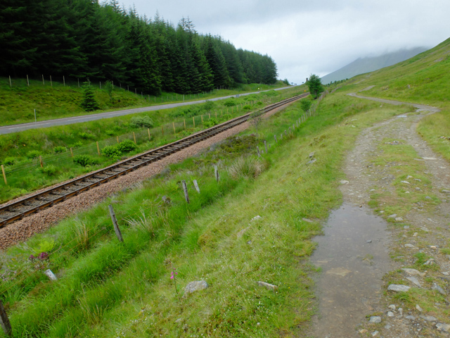
Road, rail and the West Highland Way
The A82, the West Highland Line and the West Highland Way follow the pass below Beinn Odhar.
West Highland Way
The West Highland Way is a long distance footpath, running for 154km (96miles) between Milngavie and Fort William.
It passes through countryside north of Glasgow, follows the east shore of Loch Lomond to Glen Falloch and Strathfillan, crosses Rannoch Moor to the head of Glencoe, climbs the Devils Staircase and descends to Loch Leven, before crossing the Lairigmor and Glen Nevis to finish in Gordon Square, Fort William.
 Map © Crown Copyright")
TIP: Click the map for more Large scale mapping
- Grid Square
- NN3232, 17 images (more nearby 🔍)
- Photographer
- John Allan (more nearby)
- Date Taken
- Friday, 8 July, 2016 (more nearby)
- Submitted
- Saturday, 16 July, 2016
- Subject Location
-
OSGB36:
 NN 329 327 [100m precision]
WGS84: 56:27.4332N 4:42.7188W - Camera Location
-
OSGB36: NN 329 327
- View Direction
- North-northwest (about 337 degrees)