2016
NN2747 : West Highland Way crossing The Moss
taken 8 years ago, near to Moss, The [other Features], Highland, Great Britain
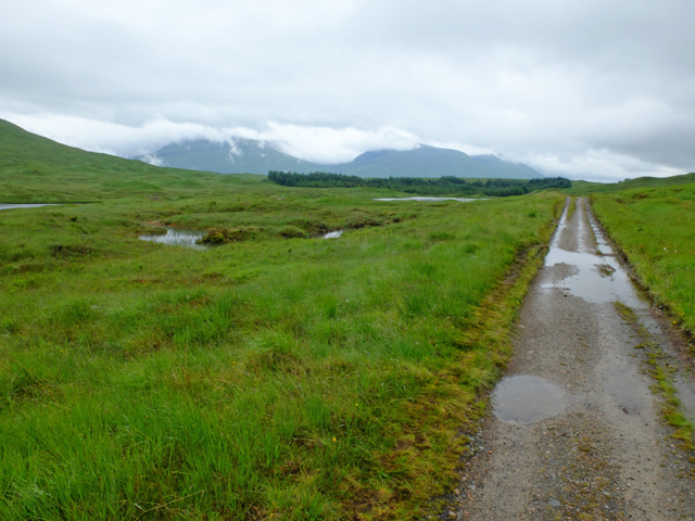
West Highland Way crossing The Moss
The old military road negotiates an area of bogs on the western side of Rannoch Moor.
West Highland Way
The West Highland Way is a long distance footpath, running for 154km (96miles) between Milngavie and Fort William.
It passes through countryside north of Glasgow, follows the east shore of Loch Lomond to Glen Falloch and Strathfillan, crosses Rannoch Moor to the head of Glencoe, climbs the Devils Staircase and descends to Loch Leven, before crossing the Lairigmor and Glen Nevis to finish in Gordon Square, Fort William.
 Map © Crown Copyright")
TIP: Click the map for more Large scale mapping
- Grid Square
- NN2747, 7 images (more nearby 🔍)
- Photographer
- John Allan (more nearby)
- Date Taken
- Saturday, 9 July, 2016 (more nearby)
- Submitted
- Saturday, 16 July, 2016
- Subject Location
-
OSGB36:
 NN 278 477 [100m precision]
WGS84: 56:35.4094N 4:48.2943W - Camera Location
-
OSGB36: NN 278 478
- View Direction
- SOUTH (about 180 degrees)