2016
NN2751 : West Highland Way towards Kings House
taken 8 years ago, near to Allt Maol Ruainidh [water Feature], Highland, Great Britain
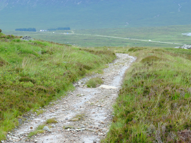
West Highland Way towards Kings House
The route follows the former motor road. The current road can be seen below.
West Highland Way
The West Highland Way is a long distance footpath, running for 154km (96miles) between Milngavie and Fort William.
It passes through countryside north of Glasgow, follows the east shore of Loch Lomond to Glen Falloch and Strathfillan, crosses Rannoch Moor to the head of Glencoe, climbs the Devils Staircase and descends to Loch Leven, before crossing the Lairigmor and Glen Nevis to finish in Gordon Square, Fort William.
 Map © Crown Copyright")
TIP: Click the map for more Large scale mapping
- Grid Square
- NN2751, 8 images (more nearby 🔍)
- Photographer
- John Allan (more nearby)
- Date Taken
- Saturday, 9 July, 2016 (more nearby)
- Submitted
- Saturday, 16 July, 2016
- Subject Location
-
OSGB36:
 NN 279 519 [100m precision]
WGS84: 56:37.6447N 4:48.4113W - Camera Location
-
OSGB36: NN 279 518
- View Direction
- Northwest (about 315 degrees)